 |
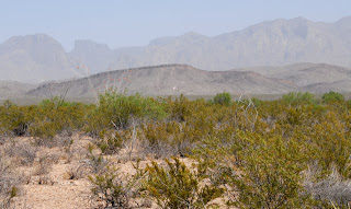
| As I was on highway 118, just a few miles north of Study Butte, I saw this interesting rock...or mountain...I'm not sure. |
 |
| Here's a little closer look at it. |
 |
| The wind was kicking up a lot of dust on my first day in the park. This is on the western edge, not too far from Maverick Junction. |
Big Bend is a large park with a few main roads and a considerable number of dirt roads. The main east/west road is approx. 50 miles long and stretches from Maverick Junction on the western side, to Boquillas Canyon on the eastern side. From that road, there is a paved road that goes to Santa Elena Canyon, another to the Chisos Basin and a third to Persimmon Gap on the northern edge of the park. And of course, along each of those, there are many other places to stop and explore.
When I first entered the western edge of the park at Maverick Junction, I decided to take one of the dirt roads called Old Maverick Road which is approx. 13 miles long. It is essentially a short cut to Santa Elena Canyon. What I didn't know at the time is that it is 13 miles of dirt road that has a washboard surface and, if you're in a truck with stiff suspension like my F-250, it will beat you to death!!! I didn't think I was ever going to get off that road. Over the next 7 days, I visited Santa Elena Canyon several times but only once did I get there by taking Old Maverick Road.
I left Big Bend this morning and will spend the next couple of nights in Alpine, located only 80 miles north on highway 118. I took hundreds of photos while in Big Bend and will be posting some of those over the next few days or weeks.
Until next time.
No comments:
Post a Comment